Versioned MissionPack
Carry the brief, boundary, objectives, access, hazards, RAMS, gate codes, completion criteria, attachments and operational-context reference into the field.
 Discuss field work ↗
The operational edge of the Tropos platform
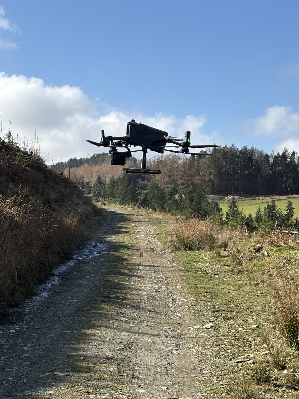
Tropos Field™ is being developed for pilots, survey crews, inspectors and field teams working away from the office. It puts the current MissionPack, operational context, checks, navigation, welfare support and attributable capture into one mobile-first field journey: even when connectivity is unreliable.
 Platform development
One guided field session
The field record begins with a versioned MissionPack and ends with synchronised evidence. Each action retains its operator, device, time, location, source and relationship to the work.
Designed around real field friction
Field™ is not a smaller Operations™ dashboard. It is the execution and capture product: focused, glove-friendly, location-aware and designed to preserve evidence until its destination acknowledges receipt.
Carry the brief, boundary, objectives, access, hazards, RAMS, gate codes, completion criteria, attachments and operational-context reference into the field.
Keep mission boundaries, plots, vector layers, GPS position and breadcrumbs available offline, with distance and bearing support for plots and return-to-vehicle navigation.
Complete equipment and pre-flight checks, verify or update preliminary findings, record GPS and time, and capture the PIC’s own Flight Authorisation decision.
Associate photos, notes, voice, forms, signatures, GPS tracks, samples and observations with the mission, plot, operator, device, place and time.
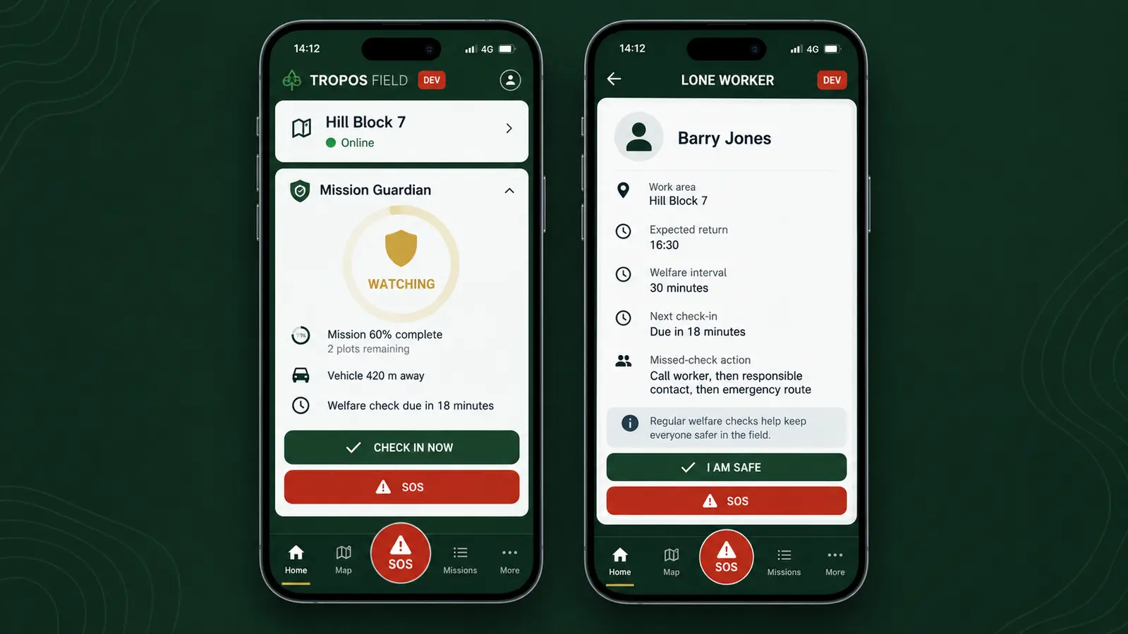
Carry the named lone-worker plan, welfare intervals, manual check-ins, missed-check actions, escalation contacts, emergency information, return-to-vehicle guidance and a visible SOS route. Current support relies on check-ins and human escalation, not claimed automatic fall detection.
Hold evidence in an offline outbox, retry when connectivity returns and retain acknowledgement, version and checksum information rather than silently assuming upload success.
Lone-working support · named responsibility
A lone-worker plan can carry the person’s name, work area, task, expected return, communication method, welfare-check interval, vehicle or access details, emergency information and the people responsible for escalation.
Field™ can prompt a manual check-in, show when one is overdue and preserve the response or missed-check record. A missed check-in must lead to a defined human response: contact the worker, follow the agreed escalation route and call the emergency services when the situation requires it.
Connectivity and device limits remain visible. Field™ does not silently treat loss of signal as proof that somebody is safe, and it does not claim automatic fall detection, guaranteed live tracking or an emergency-service connection.
Online when possible · useful when not
When connected, Field™ can receive updated mission and operational information from Operations™. Weather, NOTAM, FRZ and airspace context is shown with its source and validity. When offline, the last synchronised snapshot remains available with a clear stale warning rather than being presented as live.
An active field session locks its MissionPack version at check-in. Later changes are surfaced on synchronisation and must be acknowledged before the next session; they do not silently rewrite the work already under way.
Support for judgement, not a substitute for it
Field™ can present the plan and preliminary evidence, prompt required checks and preserve what the crew actually finds. The Pilot in Command remains responsible for verifying the real conditions, accepting or changing findings, granting or refusing Flight Authorisation, aborting when necessary and completing the post-flight record.
For non-flight work, the responsible field person likewise retains authority for safe execution, welfare and the accuracy of captured evidence.
Standalone value · connected evidence
Field™ can support standalone packages and third-party exchange. Connected to Tropos, it receives governed work from Operations™ and sends capture evidence to the appropriate domain product, without turning Field™ into the system of record for forestry analysis, agricultural decisions or commercial scheduling.
Start with the day in the field
We welcome discussions with pilots, contractors, survey teams, land managers and prospective partners about controlled field validation and practical workflow design.
Discuss Tropos Field™ ↗